Pages

Saturday, August 17, 2019

Pere Marquette River Tidbits

Pere Marquette River
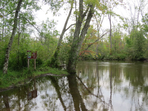
Pere Marquette River below Indian Bridge (photo by jhy)

compiled from several sources

The Pere Marquette River flows from near Baldwin, Michigan, to Lake Michigan at Ludington. It is designated as a Wild and Scenic River between the junction of the Middle and Little South Branches to Scottville Road, a distance of 66 miles. The Wild and Scenic Rivers Act of 1968 preserves certain rivers which have outstanding natural, cultural, and recreational values in a free-flowing condition for the enjoyment of present and future generations.

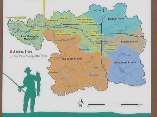
Its watershed encompasses 755 square miles, and 380 miles of streams. It is the only completely free-flowing river in the Lake Michigan watershed. Brown trout from Germany were stocked in the Baldwin River, a tributary, in 1883. These were the first brown trout in the United States. The cool river continues to be an excellent trout stream, for both rainbow and browns.
Pere Marquette River
Pere Marquette watershed (graphic by the USDA Forest Service)

The first universally designed access on the Pere Marquette has been installed at Custer Bridge, as a result of grants from the Great Lakes Fishery Commission and the Great Lakes Fishery Trust. An accessible latrine has also been added at this site.

After logging in the early 20th century stripped the banks, the river was once labeled "dead." As the Manistee National Forest was established in 1939, many reforestation projects were undertaken, and the river began to recover. Now, many agencies and organizations work together to protect the river. For example, the Lake County Road Commission has installed open-bottom culverts on some tributaries to better provide for the health of fish and aquatic wildlife.

The river is named for Jacques Marquette a Roman Catholic priest and explorer who traveled extensively in West Michigan in the 1600s. His traditional death location is near the mouth of the river, although his final grave is now located in St. Ignace.

The Wild and Scenic River designation means that the waterway will be kept in as pristine condition as possible. It does mean that permits are required to be on the water in the designated segment between the Friday of Memorial Day weekend through the Monday of Labor Day weekend. Watercraft hours are from 9:00 a.m. to 6:00 p.m.

An additional consequence of the designation is that it is unlikely the North Country Trail will ever have a single-use footbridge across the river. The crossing is now accomplished at Upper Branch Bridge on South Branch Road, and requires a short road walk to reconnect with off-road trail.

The Pere Marquette is popular with paddlers, anglers, and campers (at designated sites).

Like This!


See XXX
These links are checked on the date of the article. As the article ages, some links may become invalid

Go To www.getoffthecouchnews.blogspot.com for all the news
See Get Off The Couch


Friday, August 16, 2019

Four Hikers Rescued from Nordhouse Dunes

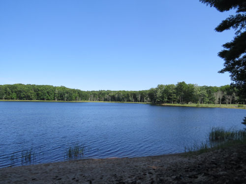
Nordhouse Lake
Nordhouse Lake (photo by jhy)

excerpted from an article in the Ludington Daily News

Four hikers were rescued on Tuesday from the Nordhouse Dunes Wilderness. They had become disoriented and were off the trails.

They left the trail head at about 6 pm on Monday but called 911 around 1:00 in the morning, telling dispatch they had very little battery life left on the phone and did not know where they were.

The Mason County Sheriff's Office, Grant Township Fire Department and Michigan State Police responded. The search continued until 6 am, when law enforcement personnel were losing battery power on their own lights. The search resumed shortly, and the group was located at 9:43, about a half mile west of the trailhead on Nurnberg Road.

The lost hikers were tired and insect bitten, but had no serious injuries and did not seek medical treatment. They also had plenty of food and water.

MSP Trooper Connor Crutchfield recommended that hikers have a map of the area, or take a photo of one of the maps posted at several trail junctions, and be sure your phone battery is fully charged. Service within the wilderness is poor.

Like This!


See Nordhouse Trail Guide Updated
These links are checked on the date of the article. As the article ages, some links may become invalid

Go To www.getoffthecouchnews.blogspot.com for all the news
See Get Off The Couch

Thursday, August 15, 2019

NCT Hillsdale County Data Book Available

Michigan Ohio border sign on North Country Trail
sign near the Michigan/Ohio border on the North Country Trail (photo by jhy)

by jhy

Because the portion of the North Country Trail in southeast Michigan is often considered to be impossible to hike unsupported, my first effort at creating a data book was directed toward this area. What I learned is that if you hike between September 11 to May 14 (when it is legal to camp in the Lost Nation State Game Area- or any Michigan SGA), and are willing to pay for an occasional motel, you can easily make it through Hillsdale County.

In fact, if you continue north, you would probably need someone to serve as a trail angel in Homer, Michigan, but that is the only stop it would be impossible to find legal lodging at reasonable hiking-day intervals. By reasonable, I mean under 15 miles. If you are willing to hike 22 miles, you can make it from the Litchfield Village campsite to the city of Albion, in Calhoun County.

This data sheet is the first of what I hope will become a series for Michigan, but there is no projected timeline for completion. This is an entirely volunteer effort, and my time and resources are limited. It includes a basic guide, mileages, water sources, lodging options, other resources, land ownership, and USGS topo quads.

It is presented along with the fledgling web site that is another of my unrealistic projects, www.exploreNCT.info. This site is added to as I have time and inspiration, but I hope to grow it into a fun and valuable resource.

You can find the link to the Hillsdale County data book under Hillsdale County on the Lower Michigan page. See ExploreNCT Lower Michigan

I hope you might check out the other pages that are currently available on the site, even if they are currently few.


Like This!


See ExploreNCT
These links are checked on the date of the article. As the article ages, some links may become invalid

Go To www.getoffthecouchnews.blogspot.com for all the news
See Get Off The Couch
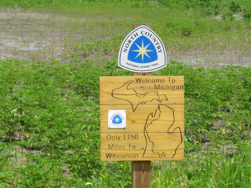

Monday, August 12, 2019

Should Eminent Domain be Reinstated?

trail in Nordhouse Dunes Wilderness
Off-road trail is a goal, but how can it be accomplished? (photo by jhy)

from a story in Outside

Jim Kern, founder of a new advocacy group called Hiking Trails for America, believes the only way to complete the National Trails System is by bringing back the ability to acquire land for trails by the use of eminent domain.

The only trail which ever had this authority was the Appalachian Trail, and there was so much backlash afterwards that the next several trails authorized (including the North Country Trail) were not only denied this tool, but they were banned from buying land. Only in recent years has Congress finally authorized the NCT to buy land, even from willing sellers.

Kern points out, “Every long, thin corridor that is important in America—a gas line, a railroad—[developers] wouldn’t think of doing it without eminent domain.”

Eminent domain for any purpose generally results in hard feelings and resentment. Amy Lindholm, who manages the Land and Water Conservation Fund Coalition replied to Kern. “I understand why you would advocate for eminent domain. It would certainly make things more expedient. But there just isn’t the political support for it.”

Currently, trails make their way across private land by means of handshake agreements, which are highly vulnerable to change, easements of various types, and outright purchase where possible.

If it were reasonable to think that trails could gain land by eminent domain, would it be worth the public backlash? Jim Kern believes it is the only way.


Like This!


See Hiking Trails for America
See The Controversial Plan to Protect America's Trails
These links are checked on the date of the article. As the article ages, some links may become invalid

Go To www.getoffthecouchnews.blogspot.com for all the news
See Get Off The Couch

Saturday, August 10, 2019

1000 New Acres of Public Land Along AuSable

alt text
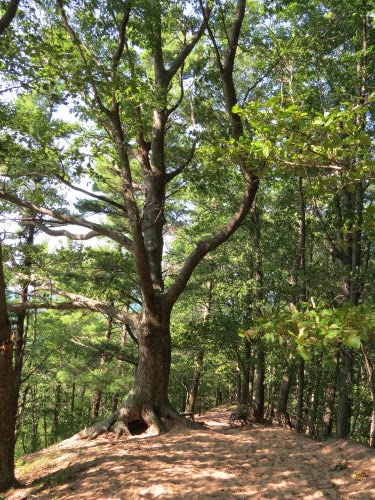
upper AuSable River (photo from the Michigan DNR)


a news release of Michigan DNR

More than 1,000 acres of prime forest land – including 1.5 miles of the Au Sable River corridor – will provide fish and wildlife habitat, forest management opportunities and be open for public recreation thanks to a grant provided to the DNR by the Michigan Natural Resources Trust Fund.

The DNR and Huron Pines will host a closing ceremony to celebrate the acquisition of the Upper Au Sable River Property at 3:30 p.m. Aug. 14 on the property near Grayling. The public is welcome.

“Public access to and protection of designated natural rivers and trout streams is a high priority for the DNR,” said Shannon Hanna, DNR natural resources deputy director. “This piece of land is nearly surrounded by state forest and increases access to the world-renowned fishing available in the Au Sable River. We appreciate the investment from the Michigan Natural Resources Trust Fund that enabled the success of this project.”

The Michigan Natural Resources Trust Fund has supported high-quality outdoor recreation opportunities for Michigan citizens and visitors for over 40 years. A restricted fund established in 1976 to support land conservation and outdoor recreation, the Trust Fund is financed through interest earned on funds derived from the development of publicly owned minerals such as oil and natural gas. Over the past 40-plus years, the Trust Fund has granted more than $1 billion to state and local units of government to develop and improve public outdoor recreation opportunities in all 83 counties.

The $2.1 million acquisition includes 1,010 acres of forest land that completes the protection and public ownership of this entire stretch of the Au Sable River. A cabin and outbuildings on the property will be removed.

The property features a mixed forest of mature oak, jack pine, white pine, and red pine as well as lowland conifers near the river, including cedar. There are also 400 acres of wetlands. The property provides habitat for game birds such as woodcock, ruffed grouse and waterfowl in addition to black bear, white-tailed deer, river otter and the threatened Eastern Massasauga rattlesnake.

Birdwatchers can find sought-after species for life lists, including bald eagles, osprey, the pileated woodpecker, waterfowl and songbirds.

“Public recreation opportunities include hunting, fishing, trapping, hiking, camping, wildlife viewing, bird watching, snowshoeing and cross-country skiing,” said Brad Jensen, executive director of Huron Pines, a Gaylord-based nonprofit organization that works to protect, restore and conserve Michigan's natural resources.

Huron Pines has developed a watershed plan for river restoration and actively partners with a variety of agencies and stakeholder groups to implement this plan. Huron Pines worked to rally these stakeholders and other organizations and businesses in support of the DNR’s efforts to acquire and protect the Upper Au Sable River property.

Directions:

From Grayling: Take M-72 west to South Au Sable Trail, which is about three-tenths of a mile west of the stop light at Ole Dam Road. Turn right (north) onto South Au Sable Trail and take it to Pollak Bridge Road. Turn left. The entrance leading back to the property will be located on the right in approximately 50 yards.

From Traverse City: Take M-72 east to South Au Sable Trail. Turn left (north) onto South Au Sable Trail and take it to Pollak Bridge Road. Turn left. The entrance will be located on the right in approximately 50 yards.

Like This!


These links are checked on the date of the article. As the article ages, some links may become invalid

Go To www.getoffthecouchnews.blogspot.com for all the news
See Get Off The Couch

Tuesday, August 6, 2019

Nordhouse Dunes Trail Guide Updated

alt text
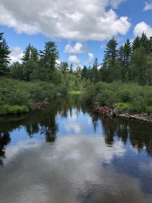
Nordhouse Lake (photo by jhy)

By Joan H. Young

The guide to Nordhouse Dunes trails (Mason County, Michigan) on the companion site to this blog has been updated.

The trails within this designated wilderness area were previously unnamed and unsigned. Recently, the trails were given names which adds a bit of character to the site. Some of the names are simply descriptive: "Nordhouse Lake Trail," but a couple of them invite further exploration of their meanings, such as: "Nippising," and "Algoma Ridge."

Surprisingly, signposts have been placed at many of the trail junctions. Generally, signage within Wilderness areas is not allowed. However, the minimal information is welcome. There are enough trails that it's nice for hikers to actually be able to know where they are.

alt text
on the Lake Michigan Trail (photo by jhy)

What is now called the Algoma Ridge Trail had been completely blocked by a straight-line wind event several years ago that filled a portion of its valley route. The Forest Service chose not to clear the way, because of the time involved to cut through the large blowdown with hand tools (no power tools are allowed in wilderness), and because wilderness areas are generally allowed to change naturally, which includes blowdowns. This trail has now been re-routed to join the Lake Michigan Trail at a slightly different location. The re-route is a good solution, as it encourages people to reach the Lake Michigan Trail by a sustainable route rather than climbing straight up the bluff when they reach the tangled trees.

I was pleased to note that a number of damaged hillsides and braided trails have begun to regenerate plant cover and heal. In recent years, overuse and abuse by people scrambling everywhere has caused a significant amount of damage. Perhaps having certain trails named and designated is encouraging hikers to remain on the established pathways.

Responsible recreation by the many users of Nordhouse will be the key to preventing the establishment of quotas by the Forest Service in the future.

Nordhouse is a highly popular destination with 3450 acres of open and forested dune ecosystem. Lake Michigan is to the west and the area includes the small kettle lake, Nordhouse Lake. It is located within the Manistee National Forest, and dispersed camping is allowed. Parking permit required.

The Get Off the Couch web site map for Nordhouse has been updated, along with all trail descriptions to reflect the new names and re-routes.

Like This!


Go To www.getoffthecouchnews.blogspot.com for all the news
See Get Off The Couch


Monday, August 5, 2019

Ludington Avenue West End Promenade Opens

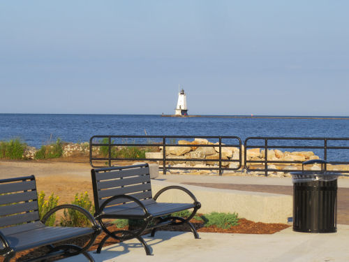
Ludington Avenue West End Promenade
Ludington Lighthouse as seen from the promenade (photo by jhy)

gathered from several sources

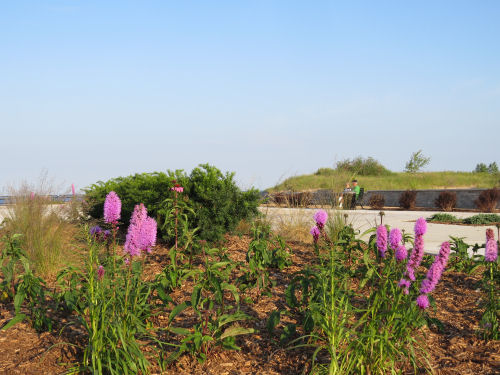
Ludington Avenue's West End project (Ludington, Michigan) opened this week to the public. Formerly, the space was entirely devoted to parking. This has been reduced to eight standard spaces and one van-accessible handicap parking spot. Now there are beds of native plants, a level paved area for gatherings, lighting, and benches.

This change has been somewhat controversial, as some people have questioned removal of so much public parking. It remains to be seen how the new space will be used.

There are several future items to be added which include a kayak rack, donor plaques, possibly bicycle racks, a drinking fountain and water bottle filling station.

The project has been funded by grants and private donations, with West Shore Bank leading the list from private donors.

Ludington Avenue West End Promenade
native plants in bloom at the promenade entrance (photo by jhy)

An official ribbon cutting will be held in the near future.


Like This!


Go To www.getoffthecouchnews.blogspot.com for all the news
See Get Off The Couch


Sunday, August 4, 2019

NCT Maps Updates Change Mile Mark Numbers

alt text
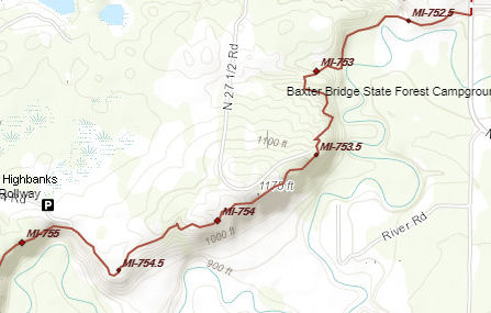
segment of online NCT interactive maps


The North Country Trail Association's online, interactive maps to the trail have become an "overnight" hit. More and more, I hear people communicating with others about meeting locations, or defining segments by referring to the mile marker numbers.

This is a good thing, but can lead to misunderstandings, if one does not realize that these numbers can change. This is the beauty of the interactive maps, given that there is still a lot of work to do to get all of the trail off road. But it can also be problematic.

For example, the NCTA just published this information. "We're releasing a new round of updates for the North Country Trail in Pennsylvania, Wisconsin and Michigan. Included in this round of updates - for the first time - are new maps that cover the NCT in Pennsylvania's Butler, Clarion and Venango Counties. These updates COMPLETE the section maps for the NCT in Pennsylvania, totaling just over 280 miles. The updates in Wisconsin and Michigan represent both trail relocations and improvements in trail data. In all cases, these updates have caused the half-mile waypoints to shift statewide in Pennsylvania, Wisconsin and Michigan."

Each state is divided into half-mile segments, beginning at the western end of the trail in the state. Michigan's mile 0.0 is at the western end of the Upper Peninsula on Lake Road, just east of Wisconsin's mile 210.5. Whenever, the route changes, all the numbers in that state which are higher than the location of the change will automatically shift to reflect the change.

Personally, I've fallen victim to updates twice in the past 3 months. One person gave directions using the mile numbers, but by the time I needed to find those locations, the numbers had shifted a bit. Our most recent chapter hike began at Highbanks Rollway. Publicity was sent out listing this as mile 754, but by the week of the hike it had shifted to mile 755. Just be aware that these changes can and will occur.

Just to be on the safe side, be sure that if a critical meeting is involved, you describe the location in "traditional" terms in addition to giving a mile number.

Just remember, number shifts are a good thing, because they almost always mean more miles off road, or a the selection of a better route.

based on information from the North Country Trail Association

Like This!


See North Country Trail maps
These links are checked on the date of the article. As the article ages, some links may become invalid

Go To www.getoffthecouchnews.blogspot.com for all the news
See Get Off The Couch

Saturday, August 3, 2019

Jupiter, Saturn, Moon to be Aligned in August

Aug 9-11, 2019 positions of the moon, Jupiter and Saturn
Aug 9-11, 2019 positions of the moon, Jupiter and Saturn (graphic by jhy)

from information at EarthSky.org

In early August of this year, the gibbous, near-full moon will be flanked in the southern sky by Jupiter to the west, and Saturn to the east.

Jupiter is the fourth brightest light in the sky, after the sun, moon, and Venus. Saturn is more golden.

Like This!


See EarthSky.org
These links are checked on the date of the article. As the article ages, some links may become invalid

Go To www.getoffthecouchnews.blogspot.com for all the news
See Get Off The Couch

Friday, August 2, 2019

Arcadia Marsh Boardwalk/Trail Opens


Arcadia Marsh, located along the Lake Michigan shoreline, in Arcadia, Michigan has just opened a trail and boardwalk across the 155-acre Arcadia Marsh Nature Preserve that is universally accessible.

This 0.75-mile trail is an easy walk for most, and is now open to those with mobility difficulties. There are trailheads on M-22 at the south edge of Arcadia, and on St. Pierre Road, between Frederick and Glover's Lake Roads. A walk out and back would be 1.5 miles. Much of the trail is on boardwalk, and includes two fishing platforms and three observation decks. The trail parallels Bowen's Creek, which flows into Arcadia Lake, and then into Lake Michigan.

More than 150 species of birds have been sighted at the marsh, along with mammals, fish and other wildlife.

Great Lakes coastal marsh ecosystems have become rare, with less than 20% of the estimated original marshlands remaining. These marshes are high in productivity and diversity. Only about 15 remain in Michigan's Lower Peninsula. Arcadia Marsh is protected by the Grand Traverse Regional Land Conservancy.

The Conservancy is seeking to acquire an additional 32 acres of grassland adjoining the marsh to serve as a buffer. Invasive species can be better controlled and development encroachment on the marsh can be held at a further distance.


from Grand Traverse Regional Land Conservancy
download a pdf map of Arcadia Marsh Trail

Like This!


See Arcadia Marsh Fundrasier to Benefit Marsh protection
These links are checked on the date of the article. As the article ages, some links may become invalid

Go To www.getoffthecouchnews.blogspot.com for all the news
See Get Off The Couch

Thursday, August 1, 2019

Portions of Pere Marquette River Re-Open after Rains

alt Indian Bridge
Indian Bridge (photo by jhy)

a news release of The Huron- Manistee National Forest

Heavy rainfall on July 20 generated significant flooding along the Pere Marquette Wild & Scenic River. Log jams have made the river impassable between Baldwin and Indian Bridge. The upper section of the river has been opened, but the USDA Forest Service has stopped issuing watercraft permits for the third section of the Pere Marquette Wild & Scenic River (between Upper Branch and Indian Bridge).

The closure will remain in effect until further notice. Crews are working to clear log jams in the river.

Like This!


See Huron-Manistee NF
These links are checked on the date of the article. As the article ages, some links may become invalid

Go To www.getoffthecouchnews.blogspot.com for all the news
See Get Off The Couch

Saturday, August 23, 2014

Pentwater to Add Shopper's Dock

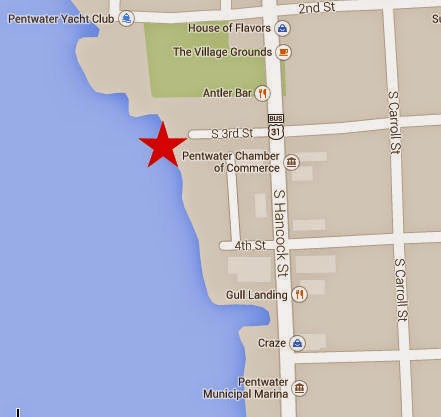
pentwater map
proposed location of transient docks

by JHY, based on a news item in the Ludington Daily News

I read with interest last week that the Village of Pentwater is planning space for boaters to be able to dock temporarily. Day users could leave their boats, shop or eat and then return to continue their voyage or recreational outing. This is known as a transient or shopper's dock.

Rob Allard, Village Manager, stated that it will not technically be a dock, but a seawall where boats can tie up for as long as three hours. It is to be located at the foot of 3rd Street. The space will accommodate boats up to 23 feet in length.

This interests me, because earlier this summer a friend and I kayaked in Pentwater Lake. There is a very small space between 4th and 5th Streets where people can park and put in small boats. When we returned to take our boats out, the entire space was taken up by some kayaks that had been pulled out and left temporarily in the area. We had to wait until the paddlers returned and cleared the space. Fortunately, we did not have to wait long, but it did emphasize the problem. You can't really leave a boat, even to go get a snack without being in someone's way.

This will be a nice addition to the services in Pentwater.

Allard said that work will begin this fall, and should be completed in the spring.

Like This!


Go To www.getoffthecouchnews.blogspot.com for all the news
See Get Off The Couch


Related Posts with Thumbnails